
Sunset Mountain Lookout
- Wizard of Wandering
- Jan 14, 2023
- 3 min read

Views from every direction - and even winter hiking!
Like most fire lookouts, you have views in all directions from the top of the summit at 7,869 feet.
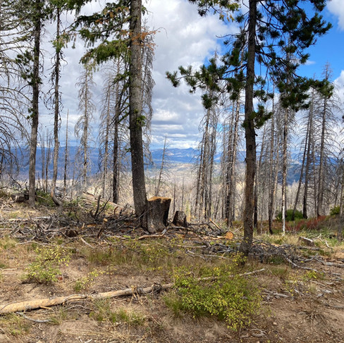
The road leading to the lookout begins at Mores Creek Summit on Highway 21 about 13 miles north of Idaho City. As you make your way to the summit, you will be surrounded by forest until you are close to the top.


Then the trees clear away to give you views in the distance toward the Sawtooths to the northeast, the Trinity Mountains to the southeast, Schaffer Butte and Mores Mountain above Boise Basin to the southwest, and also Freeman Peak and Pilot Peak closer to you toward the northwest.
Sunset Mountain fire lookout, which is staffed every summer, is in Southwest Idaho's Boise National Forest and the Boise Mountains. Started in 1930 with a Region 5 cab, the current lookout is an R-6 flat cab that was built in 1958.
From the Idaho Statesman, January 28, 1945:
"Miss Nellie Arabaugh, Pioneerville, serving on Sunset lookout, had the thrill of a lifetime when lightning struck a tree 200 feet from the lookout. Following a peal of thunder, a shutter banged against the side of the building so hard that it broke two panes of glass. Miss Arabaugh, armed with a shovel, soon had the flaming tree under control. Her labor was interrupted only when she ran to the lookout and reported another fire a few miles away."
Getting There
There are multiple ways to get to Sunset Mountain Lookout. If you use an online mapping tool, the most likely route is the one directly below. Our plan was to visit three lookouts: Deadwood, Scott Mountain and Sunset Mountain, so the route on the second map below shows our complete "tour" of fire lookouts for this trip.
The route we took:

If you are coming north on Highway 21 from Boise, it's about 33 miles (45 minutes) to Idaho City and approximately 13 miles further north on Highway 21 to the Mores Creek Summit trailhead parking lot, near Milepost 52. If you are coming from the north, it's about 20 miles from Lowman to the Mores Creek Summit trailhead parking lot. The road (or trail) to Sunset Mountain starts from the trailhead parking lot.
Idaho City Ranger District
Hwy 21, Milepost 38.5
PO Box 129
Idaho City, ID 83631
(208) 392-6681
Lowman Ranger District
Hwy 21
HC-77, Box 3020
Lowman, ID 83637
(208) 259-3361
STARTING POINT: Boise
DISTANCE FROM STARTING POINT: One way from home was approximately 60 miles
TIME TO REACH: About 1-1/2 hours
ROAD SURFACE: Dirt road up to the lookout
WHEN ACCESSIBLE: Summer, Early Fall for 4WD to the lookout; also accessible by snowshoe in winter
FEES: None
BATHROOMS: At the trailhead parking lot
RECOMMENDED VEHICLES: 4WD or AWD with high clearance
PET FRIENDLY: Off leash is allowed
WHEN WE WENT: Early Fall
Repeater: Pilot Peak 145.310 KA7ERV
I'm Here - Now What?
Bring your smart phone or a GPS
Bring your kids!
Bring your dog
Hiking
Snowshoeing
Horseback
Biking
Camping
Nearby campgrounds accessible from Highway 21:
Ten Mile
Hayfork
Bad Bear
Edna Creek (north of the trailhead)
Also unimproved campsites and pull-offs
Photography
Wildlife and plant viewing
Picnicking
The following geocaches all come from geocaching.com:
Geocache: Sunset Mountain Lookout GC1DKFQ
43.899383, -115.647617
HINT: "decon container hanging in a small tree alongside the road"
Geocache: At the End of the Road GC31TFZ
43.915967, -115.656183
"Out on an ATV ride enjoying the area and decided to hide another cache in the area. It’s an ammo can. No hints."
Geocache: WJK Cache GC2AY71
43.931500, -115.669567
"This Cache is named for my grandparents who love this area very much, nothing is better than Highway 21 and the drive to Lowman. So I thought it was appropriate to place this cache at Morris Creek Summit since it comes up in about every conversation." HINT: Stumped
Geocache: Mores Creek GC22D4
43.932883, -115.671950
"About an hour from Boise on a State Highway. The cache is located just off a secondary road to a lookout and can be reached by car. If you travel by truck, head on up the road to the lookout for a great view. The lookout is about 3 miles up, but the road is a little rough. The cache is in a red ammo can. It is placed at the base of a large tree."
To learn more about geocaching and the app, go to www.geocaching.com.


Comments