

From Gig Harbor to Whistler & Back
A Three-Day Northwest Road Trip
Gig Harbor • Point Roberts • Vancouver • Whistler • Pemberton • Harrison Hot Springs • Lynden • Bellingham • Chuckanut Drive
There are road trips where the destination is the whole point—and then there are road trips where the road itself becomes the adventure.
Our three-day loop from Gig Harbor to British Columbia and back was definitely the second kind.
We started on Thursday, August 20, with a plan that looked wonderfully ambitious on the map: cross the Tacoma Narrows, head north through Blaine, make a detour into the wonderfully strange little corner of Washington known as Point Roberts, cross into Canada, continue through Vancouver and up the spectacular Sea-to-Sky Highway to Whistler.
And that was only Day One!
By the time we pulled back into Gig Harbor on Saturday, we had crossed international borders several times, driven along ocean shorelines, climbed into the Coast Mountains, explored a mountain town, discovered Pemberton, visited family in Abbotsford, wandered the shores of Harrison Lake, eaten our way through several small towns, and finally wound our way home along Bellingham Bay and Chuckanut Drive.
It was a lot of road.
It was also a lot of fun.
Day One: Gig Harbor → Point Roberts → Canada → Whistler
We left Gig Harbor on Thursday morning and headed north, crossing the Tacoma Narrows Bridge and continuing toward Blaine, where we crossed into Canada.
The first unusual stop of the trip was Point Roberts, that wonderfully quirky little piece of Washington that seems to have been designed by a map maker with a sense of humor.
Point Roberts is a 4.9-square-mile peninsula that hangs below the 49th parallel. Although it is part of Whatcom County, Washington, it is surrounded by British Columbia on its landward side. The international boundary runs right across the peninsula, making this one of those places where geography gets wonderfully complicated.
A Bite at Salt Water Cafe
We stopped at Salt Water Cafe for something to eat before beginning our little Point Roberts exploration. It was a great introduction to the relaxed personality of the peninsula—a place where the pace seems to slow down as soon as you arrive.
The cafe is known for espresso drinks and homemade bakery items, with an outdoor patio overlooking the water.
Now time to explore.
Where Washington Ends and Canada Begins
Our next stop was Monument Park, up in the northwest corner of Point Roberts. Here we found the monument marking Boundary Marker No. 1, the first marker along the 49th-parallel boundary. The park sits right at the international boundary and offers a wonderfully quiet view toward the Strait of Georgia.
From there we headed down to Lighthouse Marine Park, at the southern end of the peninsula, and then over to Lily Point Marine Reserve.
Lily Point is a particularly beautiful piece of shoreline, with forest, bluffs and sweeping views. It is also an excellent place for birdwatching and wildlife spotting.
We worked our way back along Boundary Bay, then headed toward the border crossing and—just like that—we were back into Canada.
And now the real road trip was beginning.
Vancouver Traffic vs. the Mountains
We headed north through Vancouver, and this is where our peaceful little road trip took a decidedly different turn.
Traffic. Lots of traffic. Very heavy traffic.
We were more than ready to escape the city.
Thankfully, once we began heading north toward Squamish, the landscape started changing dramatically. The buildings fell away, the road opened up, and suddenly we were traveling through one of British Columbia's great scenic corridors.

The Sea-to-Sky Highway lives up to its name. The route between Vancouver, Squamish and Whistler winds through mountains, forests, viewpoints and along Howe Sound, and is widely regarded as one of the world's spectacular drives.

This was exactly the kind of road we had hoped to find.
Squamish, Garibaldi and That Mountain!
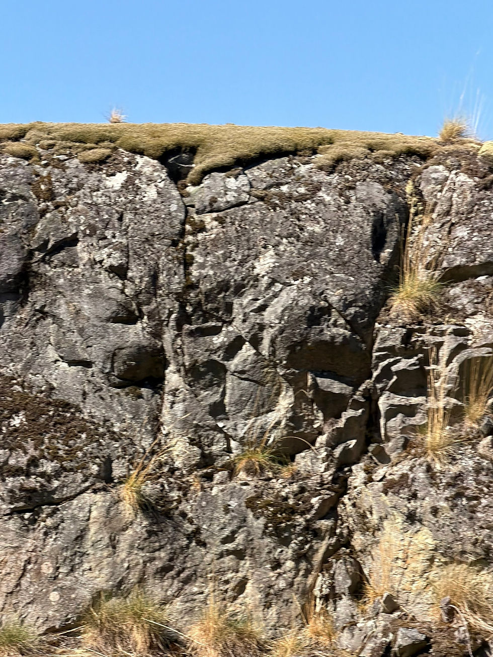
We passed through Squamish, with enormous granite walls and mountain peaks appearing everywhere we looked. And we learned about the Squamish people and saw some more beautiful scenery!
And then came the Garibaldi area. The scenery became almost ridiculous.
At one point we spotted an especially sharp, dramatic peak rising above the surrounding mountains and immediately thought: “What a sharp peak on that mountain!”
We later realized that we may well have been looking toward the unmistakable Black Tusk, a striking volcanic rock pinnacle in Garibaldi Provincial Park. The Black Tusk rises to 2,319 meters and is visible from great distances.
There are plenty of tempting stops along this section of the highway such as Shannon Falls, just south of Squamish, plunging 335 meters and is an easy roadside detour.
But on this trip, Whistler was calling.
Whistler: Mountain Village Magic
We arrived in Whistler and checked into our condo at Stoney Creek Lagoons.
We immediately liked the location. It was quiet enough to feel like a retreat, but close enough to walk into the village. The complex is in Village North, within easy walking distance of Whistler Village and the lifts. After a long day in the car, we were ready to stretch our legs. So we headed into Whistler Village.

The village was lively, colorful and buzzing with people. We wandered through the shops, checked out the streets and generally enjoyed the atmosphere before deciding it was time for dinner.
Fish & Chips and People Watching
We settled onto the outdoor deck at the Beacon Pub & Eatery for fish and chips. And what a perfect place for people watching! The Beacon sits right in the heart of Whistler Village, and its patio is practically designed for watching the world stroll by. And there were plenty of people to watch.
After dinner, we wandered through the village a little longer before finally heading back to our condo. It had been a big day. And we wanted an early start the next morning.
Day Two: Whistler → Pemberton → Abbotsford → Harrison Hot Springs
Friday morning arrived, and we were excited to see what was north of Whistler. We headed toward Pemberton, driving past beautiful Green Lake and deeper into the mountains. Pemberton sits at the foot of Mount Currie and is surrounded by the Coast Mountains. It is only about 30 minutes north of Whistler, but it feels like a completely different world.
And we really liked it.
An Unexpected Breakfast in Pemberton

We weren't sure where to stop for breakfast. Then we discovered Grimm's Gourmet Deli and Pizza. Sometimes the best road-trip meals are the ones you didn't plan. We stopped for a homemade-style breakfast and ended up having a wonderful conversation with Mark, the owner. Mark was energetic, enthusiastic and clearly passionate about his business and the food they serve. That enthusiasm came through in both the food and the service. Also, check out the picture with the "Abbey Road" crossing with the bears - right there in downtown Pemberton!
And then Mark gave us another reason to explore.
Pemberton is the seed potato capital of Canada.
Well, naturally, once we heard that, we had to go see the potato fields! So we took a short drive outside town to see them for ourselves before turning around and beginning our journey south.
Because that's what road trips are about—sometimes you just have to go see the potatoes.
Back Through Vancouver and On to Abbotsford
We retraced our route toward Vancouver and, unfortunately, found ourselves back in the traffic we had been so happy to escape the day before. Eventually we worked our way east toward Abbotsford, where we met up with Bob's cousin, John, and his wife, Cheryl. It was great to sit down together, catch up and hear about all of their latest adventures. These unexpected family visits are one of the things that make a road trip special. The route may be planned, but the memories aren't.
After our visit, we continued east toward Harrison Hot Springs.
Harrison Hot Springs: A Surprise at the End of the Day
By the time we reached Harrison Hot Springs, we were ready to slow down. We checked into a small studio and headed out to explore the town and find somewhere nearby for dinner. The first evening was really just a quick look around. It had been a long day, and we were tired. But the next morning, we had more time.
And we discovered that Harrison Hot Springs is much larger than we had expected! The community sits at the southern end of Harrison Lake, with mountains rising around it and a broad sandy beach along the waterfront.
We spent some time exploring the town and checking out the beach. It was a completely different mood from Whistler. Whistler had been busy, energetic and full of people. Harrison felt like a place where you could simply stop for a while and breathe.
The hot springs have a long history in the area, too. The Sts'ailes people have revered the mineral waters as a healing place for thousands of years, long before European settlers arrived.
By now, however, our little adventure was winding down. It was time to head home.
Day Three: Harrison Hot Springs → Lynden → Bellingham → Chuckanut Drive → Home

Saturday morning we packed up and decided to cross back into the United States at Aldergrove. Once across the border, we headed for Lynden. And we had breakfast at Dutch Treat Cafe. Lynden is a fun place to pause on a road trip, with its Dutch heritage, tidy downtown and small-town atmosphere. Dutch Treat is located right in downtown Lynden at 206 3rd Street. Breakfast was just what we needed before the final leg of our journey.
From Lynden, we headed south toward Sunset Drive and then into Bellingham.
Rather than simply jumping back onto I-5, we decided to follow the waterfront.
That turned out to be a great choice.
Bellingham to Chuckanut Drive
We wound our way along the Bellingham waterfront and then headed south toward Chuckanut Drive. Neither of us had traveled this road before. And we had no idea what we had been missing.
Chuckanut Drive is one of those roads where you should resist the temptation to hurry. The highway winds along the mountainside with views toward the water, forests and islands.
And then we discovered Larrabee State Park. “Oh! There's a park here?” Actually, there is a very large park here. Larrabee covers 2,748 acres and has more than eight miles of saltwater shoreline along Samish Bay. It was also Washington's first state park.
The park has beaches, forests, trails, lakes and mountain views, making it much more than a quick roadside stop.
The history of Chuckanut Drive is pretty fascinating, too. The road dates back to the early 1900s and was developed as a scenic highway along the shores of Bellingham and Samish bays. It is easy to see why people wanted to preserve this landscape. The road winds. The water appears. The trees close in. Then another spectacular view opens up. And you find yourself saying, “Why haven't we driven this before?”
Back to Gig Harbor
Eventually, Chuckanut Drive gave way to Burlington, and we rejoined I-5 for the final run south. The mountains and waterfront scenery slowly faded behind us. The road became familiar again. And eventually we were back in Gig Harbor.
Home. A little tired. Very happy.
And already thinking about where the next road might take us.


Comments